Aix-en-Provence is known as “the town of water, town of art”. Aix is known for its dual identity, on which it was build and has developed. But the town is also a blend of different eras and cultures.
Established in 122BC, the Romans established the city on the site with springs of water. Some of them were hot springs. As a Roman Colony, the town was a stepping stone between Italy and Spain, and developed as a urban trading centre and spa. With the spread of Christianity a new era began. Aix was made a diocese in the early 5th century and then became the seat of the Archbishop of the ecclesiastical province. It is now the capital of the region.
You can click on the pictures for a larger view.


.
.
.
.
.
.
.
.
.
.
.
.
.
.
In a region where water is scarce and precious, Aix has been supplied by its many springs. But in the second half of the of the 19th century, works on the Verdon canal and the Zola dam brought water in abundance through the basins of fountains.
The most imposing fountain is without doubt the Rotunda fountain. Its construction in 1860 marks a turning point; not only are its dimensions exceptional for this city but it is also the first to have a fonted basin. Three statues: Justice, Agriculture and Fine Arts adorn the fountain and recall the main activities of this town. In effect the fountain was a symbolic mark of the entry to the modern town, without rampart nor gate, open to the world. Aix has grown now and today the "great Fountain" is at the centre of the town.
.
.
.
.
.
.
.
.
.
.
.
.
.
The Cours Mirabeau is a wide thoroughfare, planted with double rows of plane-trees, bordered by fine houses and decorated by fountains. It follows the line of the old city wall and divides the town into two sections. The new town extends to the south and west; the old town, with its wide but irregular streets and its old mansions dating from the 16th, 17th and 18th centuries, lies to the north. Along this avenue, which is lined on one side with banks and on the other with cafés, is the Deux Garçons, the most famous brasserie in Aix. Built in 1792, it has been frequented by the likes of Cézanne, Zola and Hemingway.

.
.
.
.
.
.
.
.
.
.
.
.
.
.
The towns population is 140,000.

.
.
.
.
.
.
.
.
.
.
.
.
.
.
Judging by the name, this has to be a red-neck bar. It has to translate to "Bubba's Bar".


.
.
.
.
.
.
.
.
.
.
.
.
.
.
I was impressed with the farmers markets.


.
.
.
.
.
.
.
.
.
.
.
.
.
.
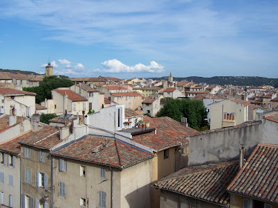
The streets are very narrow.
.
.
.
.
.
.
.
.
.
.
.
.
.
.
.
Lots of cafes and stores for shopping.


.
.
.
.
.
.
.
.
.
.
.
.
.
I love the Smart Cars. It doesn’t matter which way you park them.
.
.
.
.
.
.
.
.
.
.
.
.
.
The food and dining was fantastic.

 The Saint Sauveur CathedraleBuilt on a temple of Apollo, according to the legend, the Cathedral developed between the 5th and 18th centuries. This architectural melting pot is distinguished with a mere glance at its facade. On the right, to the south, the Romanesque gate from the 12th century adjoins a Roman wall, whilst on the left, to the north, the vast, richly carved Gothic gate from the 15th and the 16th centuries is surmounted to the north by a church tower erected between 1323 and 1425. Inside are three naves of different styles (Romanesque,Gothic and Baroque), which flank the Baptistère which rests on an octagonal stand dating back to the 5th century. Its central font recalls the ancient riteof baptism by immersion.


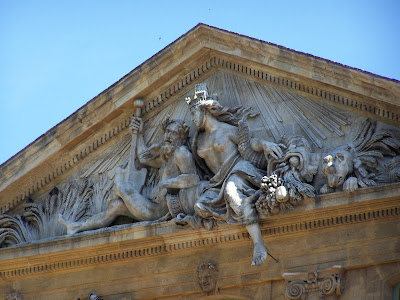
 The Corn exchange Designed by the Vallon architects, this 18th century building recalls the importance of the wheat trade at the time. The north facade is crowned by an allegoric pediment attributed to Chastel, representing the two essential elements of farming prosperity in Provence: the Rhone and the Durance rivers. The southern part overlooking the Place Richelme is rich in decorative motifs associated with the purpose of the building, fruits, cereals and olives

The Clock Tower. Former belfry of the town and symbol of local government power, the tower spans the street on Roman foundations. Erected in 1510, it houses an astronomic clock built in 1661, containing four wooden statues. The Four Seasons fountain by the sculptor Chastel in the 17th century is surmounted by a Roman column in its core.

.
.
.
.
.
.
.
.
.
.
.
.
The hotel we stayed in had the remains of an old Roman era building.
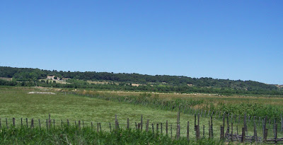
Traveling to Montpellier we drove through some beautiful French countryside


.
.
.
.
.
.
.
.
.
.
This picture is of the more modern part of Montpellier.
.
.
.
.
.
.
.
.
.
.
.
.
.
.
This picture shows the Roman aqueduct in Montpellier.


